Most people picture Death Valley as a furnace, and in July they are right. But visit in December and the same valley feels completely different. Mornings are crisp, afternoons are mild, and you can walk across a salt flat without worrying about the heat. That is why Death Valley in winter is the park’s busy season, and why it deserves a place on your cold-weather travel list.
This guide covers what winter weather is really like, the best sights and short hikes, the 2026 road closures you need to know about, and how to plan fees, camping and driving routes. Facts were checked against the National Park Service on 17 November 2026, but desert conditions change fast, so always confirm before you go.
Why Visit Death Valley in Winter?
Death Valley National Park straddles the California–Nevada border. It is the largest national park in the lower 48 states, and it holds some striking records. Badwater Basin sits 282 feet (86 metres) below sea level, the lowest point in North America. Meanwhile, Telescope Peak rises to 11,049 feet in the Panamint Range above it.
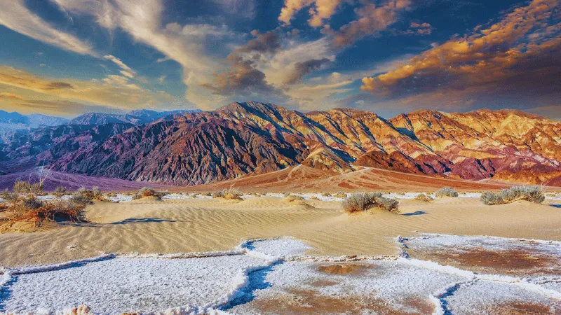
Summer here is dangerous. The park service says summer highs often pass 120°F (49°C) in the shade. In winter, however, the low valley becomes one of the most comfortable places to hike in the American West. You can explore canyons in the middle of the day, watch sunsets in a light jacket and see snow on the high peaks from the valley floor.
The landscape also has deep human history. The park is the homeland of the Timbisha Shoshone, who still live in the valley today. Later, borax miners and their famous mule teams left their mark, and you can still see some of their ruins near Furnace Creek.
What the Weather Is Really Like
According to the park’s official weather page, average conditions at Furnace Creek look like this:
- November: highs around 77°F (25°C), lows around 48°F (9°C).
- December: highs around 65°F (18°C), lows around 38°F (3°C).
- January: highs around 67°F (19°C), lows around 40°F (4°C).
- February: highs around 73°F (23°C), lows around 46°F (8°C).
Those are valley-floor numbers. Temperatures drop 3 to 5°F for every thousand feet you climb, so viewpoints like Dante’s View feel much colder, especially in the wind. Valley nights only occasionally reach freezing, but the record low at Furnace Creek is 15°F (−9°C). Therefore, pack a warm layer, a hat and gloves for early starts.
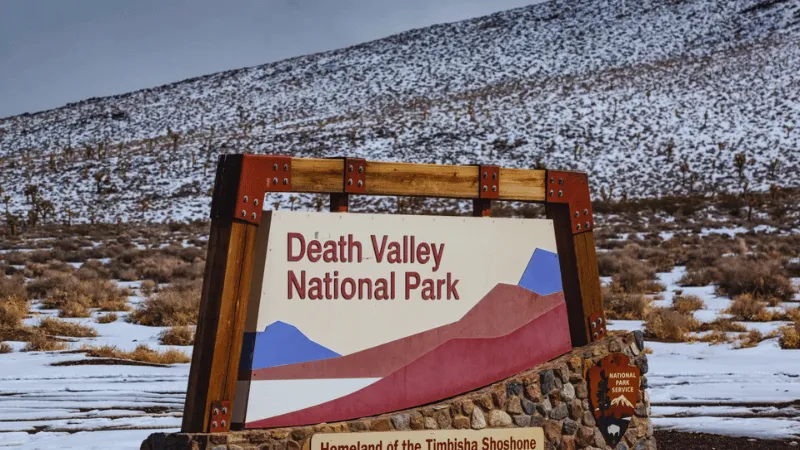
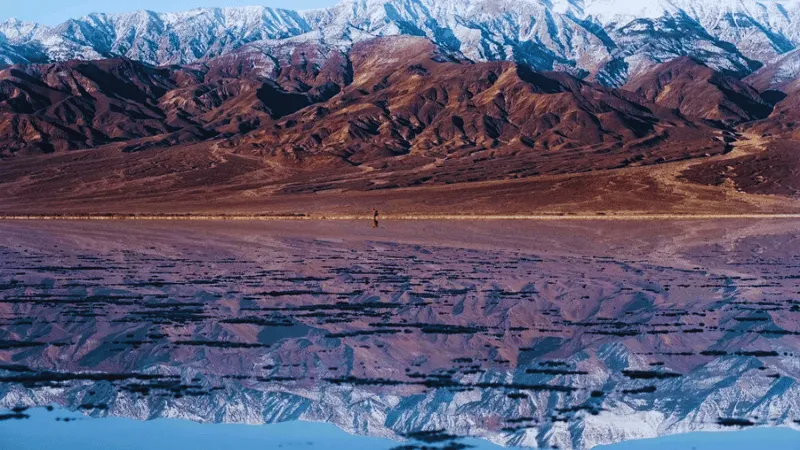
Winter also brings the park’s rare storms. Rain is uncommon, yet a single storm can wash debris onto roads and close them for months. After heavy rain, Badwater Basin can even hold a shallow temporary lake, which makes for remarkable reflection photos.
Road Closures to Know Before You Go (November 2026)
This is the most time-sensitive part of the guide. Flooding on 1 November 2026 caused new damage, and older flood repairs are still underway. Here is what the park’s alerts and conditions page listed when we checked:
- Scotty’s Castle and Bonnie Clare Road: closed for flood recovery, including to pedestrians, with no reopening date.
- Titus Canyon Road: closed for repairs, with reopening expected in May 2027. No cyclists or hikers.
- Darwin Falls access road: closed and likely to stay that way until summer 2027. Hikers can park on the shoulder of CA-190 and walk in.
- Cottonwood and Marble Canyon roads: closed after the 1 November flooding.
- Hunter Mountain Road: closed because of very muddy conditions.
- North Highway: open, but watch for flood debris on the road.
- Lower Wildrose Road: open with caution. It is washed out in places, vehicles over 25 feet are banned, and low-clearance cars are not recommended.
The good news is that the classic first-visit highlights around Furnace Creek and Stovepipe Wells were not on the closure list. Still, check the conditions page the night before each drive, because one storm can change the picture overnight.
Best Things to Do in Death Valley in Winter
Walk Out onto Badwater Basin
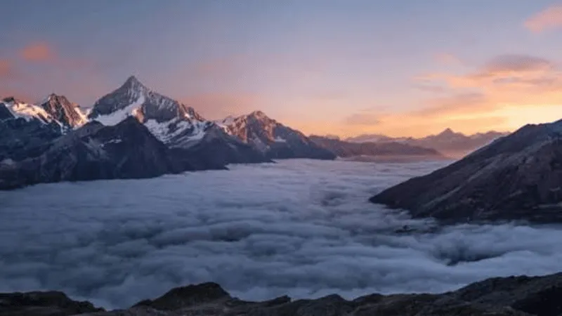
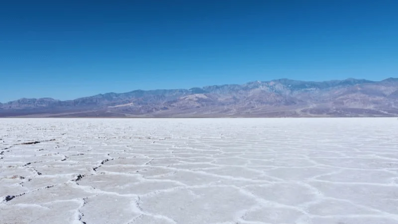
Badwater Basin is the park’s signature stop. A short boardwalk leads from the parking area onto a vast white salt flat. Keep walking past the crowds and the crust breaks into hexagon-like salt patterns that stretch toward the mountains. Look back at the cliff behind the car park and you will spot a sign marking sea level high above your head.
Winter is the only sensible season for a longer walk here. The salt reflects light strongly, so wear sunglasses and sunscreen even on a cool day.
Watch Sunrise at Zabriskie Point
Zabriskie Point overlooks a maze of golden, folded badlands. At sunrise, the first light hits the ridges and turns them amber and pink. A short paved path climbs from the car park to the viewpoint. Afterwards, you can drop into the badlands on foot via the Badlands Loop, a route of roughly two and a half miles.
Hike Golden Canyon and Gower Gulch
Golden Canyon is the best introduction to hiking in the park. The trailhead sits about two miles south of Highway 190 on Badwater Road. From there, you can choose a short out-and-back walk or a longer loop. The park service lists round-trip routes of roughly 2 to 7.8 miles, depending on whether you continue to Red Cathedral, Zabriskie Point or Gower Gulch.
The full loop through Gower Gulch makes a fine half-day outing in winter. However, it is still exposed, so carry plenty of water and start early on warmer days.
Drive Artists Drive at Golden Hour
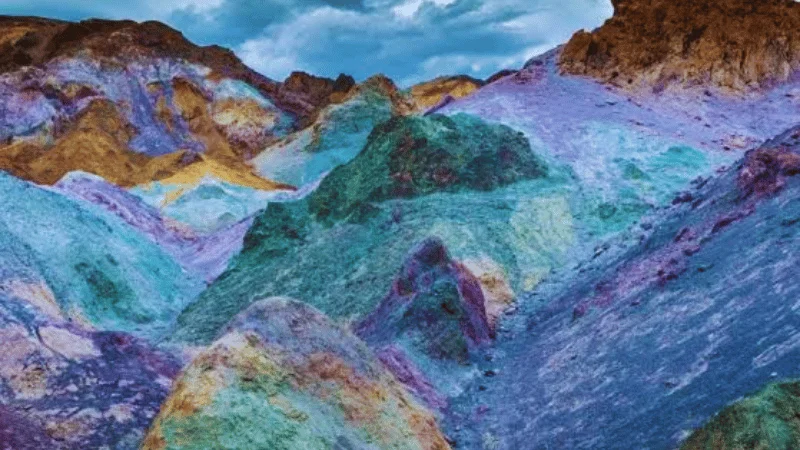
Artists Drive is a nine-mile paved road that winds through hills streaked with red, green, yellow and purple. These colours come from volcanic deposits and oxidised minerals. The road is one-way, it has sharp dips and turns, and vehicles over 25 feet are not allowed. Stop at Artists Palette, roughly halfway along, where the colours are richest. Late afternoon light brings out the best tones.
Look Down from Dante’s View
Dante’s View sits at about 5,476 feet on the crest of the Black Mountains, more than a mile above Badwater. From the edge, the salt flat spreads out below like a white river, with Telescope Peak across the valley. The final stretch of the access road is steep and narrow, so longer vehicles must stop at a lower parking area. Bring a warm jacket. It is often far colder and windier up here than at Furnace Creek.
Wander the Mesquite Flat Sand Dunes
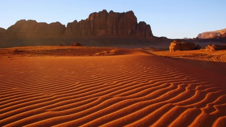
Near Stovepipe Wells, the Mesquite Flat Sand Dunes offer the classic rippled-sand scenery that many visitors expect from a desert. There is no fixed trail. Instead, you simply walk out and climb whichever crest looks best. Early morning is ideal, because the light is soft and the wind has not yet erased the overnight animal tracks. If you love dune landscapes, compare them with the red giants in our Sossusvlei and Deadvlei guide to Namibia’s dunes.
Step Back in Time at Harmony Borax Works
Just north of Furnace Creek, a short, easy path loops around the ruins of a borax processing plant from the 1880s. Interpretive signs explain how the famous twenty-mule teams hauled heavy wagons across the desert. It is a quick stop, but it adds useful context to everything else you see.
Stargazing and Photography
Death Valley is a certified International Dark Sky Park, and winter nights are long. On a clear, moonless evening, the Milky Way and thousands of stars appear above the salt flats. Badwater Basin, the Mesquite Flat dunes and Harmony Borax Works all make good foregrounds.
For photography by day, plan around the light:
- Sunrise: Zabriskie Point or the Mesquite Flat dunes.
- Midday: canyon hikes, when deep walls offer shade and contrast.
- Late afternoon: Artists Drive and Artists Palette.
- Sunset: Dante’s View or the salt flats at Badwater.
Remember that launching drones is generally prohibited in US national parks. In addition, stay on established roads, because off-road tyre tracks scar the desert for years.
How to Reach Death Valley
Most international visitors fly into Las Vegas. Furnace Creek is about 130 miles away, which usually takes around two and a quarter to two and a half hours by car. The common route heads west on Highway 160 to Pahrump, then continues to Death Valley Junction and joins CA-190 into the park.
From the Los Angeles area, expect a drive of roughly four and a half to five hours, depending on traffic and your route. Public transport does not serve the park, so you will need a rental car or a guided tour. A standard car is fine for the main paved highlights. However, many backroads need high clearance, and several are closed in 2026, as noted above.
Entrance Fees, Camping and Where to Stay
Entrance Fees
According to the official fees page, a private vehicle pass costs $30 and is valid for seven days. A motorcycle pass is $25, and visitors on foot or bicycle pay $15 per person. No entry reservation is required. Importantly, the park does not accept cash, so bring a card or buy your pass online beforehand.
If you plan to visit several US parks, compare the America the Beautiful annual passes. The park lists the non-resident version at $250, while the resident pass costs $80.
Camping in Winter
Furnace Creek Campground is the most convenient base. From 15 October to 15 April, sites can be reserved up to six months ahead on Recreation.gov. The park notes that it has booked to capacity most days in recent years. So book as soon as your dates are firm, especially for holidays and weekends.
Stovepipe Wells and Mesquite Spring campgrounds were open when we checked. In contrast, Texas Springs and Sunset were under seasonal closure, and Emigrant Campground was closed indefinitely for water system repairs. Wildrose was open but had no water.
Hotels and Lodges
Lodging inside the park is limited. The main options cluster at Furnace Creek, Stovepipe Wells and Panamint Springs, and winter weekends fill early. If those are full, some travellers stay in Pahrump or Beatty in Nevada and drive in each day. That adds driving time, so plan your sunrise and sunset stops carefully.
Travel Tips for Death Valley in Winter
- Fuel up early. Distances are huge, and fuel stops are few. Never let your tank run low.
- Carry water anyway. Cool air hides dehydration. Bring more water than you think you need, even for short walks.
- Expect weak signal. Cell coverage is patchy. The park has also scheduled maintenance power outages on several December 2026 days, which can affect phones and EV chargers. Download offline maps.
- Layer up. A sunny 65°F afternoon can turn into a near-freezing night, especially at higher elevations.
- Respect closures. Driving around a closed road damages the desert and can leave you stranded far from help.
- Check the forecast. Use the National Weather Service Death Valley page each morning. Avoid narrow canyons when rain is forecast, because flash floods can occur.
If this is your first big road trip abroad, our beginner’s guide to planning the perfect vacation covers budgets, bookings and packing in more detail.
A Simple Two-Day Winter Itinerary
Day one: Start with sunrise at Zabriskie Point. Next, hike Golden Canyon in the morning. After lunch at Furnace Creek, drive south to Badwater Basin. Then return north through Artists Drive in the late afternoon light, and finish with sunset from the salt flats or Dante’s View.
Day two: Head west for an early walk on the Mesquite Flat Sand Dunes. Afterwards, stop at Harmony Borax Works on the way back. Spend the evening stargazing away from lodge lights.
With a third day, you could drive north to Ubehebe Crater, but check the North Highway conditions first.
Final Thoughts on Death Valley in Winter
Death Valley in winter shows the park at its friendliest. The heat that keeps people away in summer gives way to mild days, cold starry nights and long walks across salt, sand and golden badlands. Plan around the 2026 closures, book camping early, bring a card for fees and pack layers. Do that, and you will see why so many travellers save this desert for the coldest months of the year.
Time-sensitive information: road status, fees and campground details were checked on 17 November 2026 and may change.
Explore More Destinations
Hooked on deserts? Explore our worldwide guides to dramatic dry landscapes, from Jordan’s red canyons in the Wadi Rum desert guide to the rain-filled lagoons of Lençóis Maranhenses in Brazil. Planning more of North America? Catch millions of wintering butterflies with our monarch butterfly sanctuaries guide, or save the turquoise water of Moraine Lake in Banff for summer. LessExplore is full of hidden gems, hiking destinations, waterfalls and practical travel tips for your next adventure.
FAQ Section
Yes. Winter is the best season for most visitors. Average highs at Furnace Creek range from about 65°F to 73°F between December and February, which makes hiking comfortable. Nights are cold, so pack warm layers.
Average December lows at Furnace Creek are around 38°F (3°C), and valley nights occasionally reach freezing. Higher viewpoints such as Dante’s View are much colder and windier, and the high peaks can carry snow.
A private vehicle pass costs $30 and is valid for seven days. Motorcycles pay $25, and visitors on foot or bicycle pay $15 per person. The park is cashless, so pay by card or buy online.
In mid-November 2026, Scotty’s Castle, Titus Canyon Road, the Darwin Falls access road and the Cottonwood and Marble roads were closed. The main highlights near Furnace Creek were not on the closure list. Check the park’s alerts page before you travel.
Furnace Creek is about 130 miles from Las Vegas, usually a drive of around two and a quarter to two and a half hours. Most drivers go via Pahrump and Death Valley Junction, then follow CA-190 into the park.