Imagine walking through cloud forest, then stepping into a meadow where palm trees rise like giant green matchsticks. That is the Cocora Valley hike in Colombia’s coffee region. The trees are Quindío wax palms, and some reach about 60 metres. This guide covers the route, the jeep ride, costs, weather and the mistakes that trip up first-time visitors.
You will also learn when to go, what to pack and how to plan your day from Salento. By the end, you will know how to enjoy one of South America’s most photogenic walks without stress.
Cocora Valley Overview
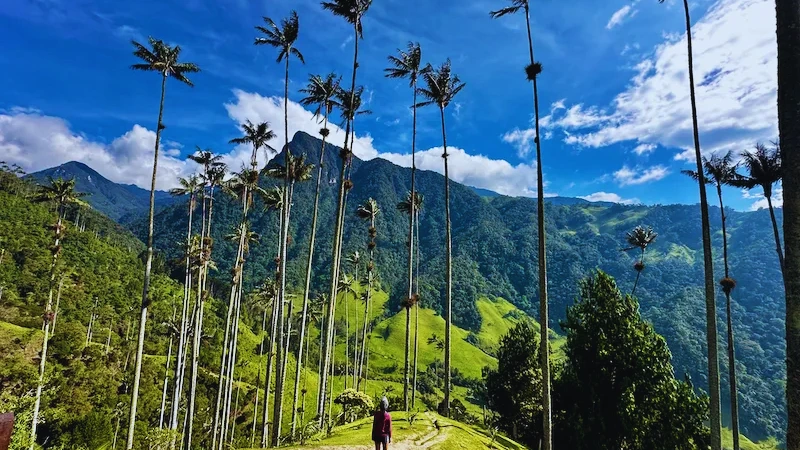
The Cocora Valley (Valle de Cocora) lies in the Quindío department, in the Central Cordillera of the Andes. The nearest town is Salento, about 11 km away. According to Wikipedia’s Cocora Valley entry, the valley sits in the upper reaches of the Quindío River and forms part of Los Nevados National Natural Park.
Elevation runs from roughly 1,800 to 2,400 metres, depending on where you stand. The air feels cool and fresh, and clouds often drift through the valley by midday. Because of that, mornings give the clearest views.
Most visitors base themselves in Salento, a colourful village known for coffee and balconies. From there, the valley is an easy day trip. The classic loop takes most of a day, so plan accordingly.
Why the Wax Palms Matter
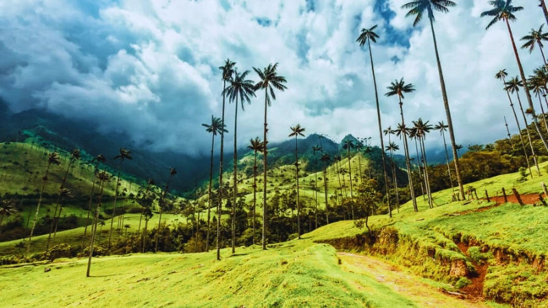
The Quindío wax palm (Ceroxylon quindiuense) is the star of the valley. It is often described as the tallest palm in the world. Trunks can climb up to about 60 metres, and they stand slim and pale against the green slopes.
The tree is also Colombia’s national tree. A 1985 law declared it a national symbol and banned its felling. That protection matters, because palms were once cut for wax and for Palm Sunday celebrations. Today, conservation groups and local farmers work to protect young palms.
You will notice many palms stand alone in open pasture. Cattle grazing makes it harder for seedlings to grow. As a result, the valley is a living lesson in how farming and conservation must share the land. Stay on marked paths, and you help young palms survive.
For more background and photos, see Atlas Obscura’s page on the wax palms of Cocora Valley.
How to Get to Cocora Valley
From Salento by Willys jeep
The usual way is a classic Willys jeep from Salento’s main square, Plaza de Bolívar. The ride takes about 30 minutes. Jeeps generally leave once they are full, so there is no strict timetable. Early departures start around 6:30 to 7:30 am, according to recent traveller reports.
Fares change from year to year. Recent sources list roughly COP 5,000 to 10,000 one way per person. Ask the driver before you climb in. Also arrange your return time, because the last shared jeeps usually leave in the late afternoon.
From Armenia or Pereira
Salento is the gateway, so you first need to reach it. Buses run to Salento from Armenia and Pereira, and each trip takes roughly one hour or a little more. From there, switch to a jeep. If you stay overnight in Salento, you can start at sunrise and beat the crowds.
Planning tip: Wikivoyage’s Valle de Cocora guide keeps community-updated notes on transport and trail conditions. Check it before you go.
The Classic Cocora Valley Hike
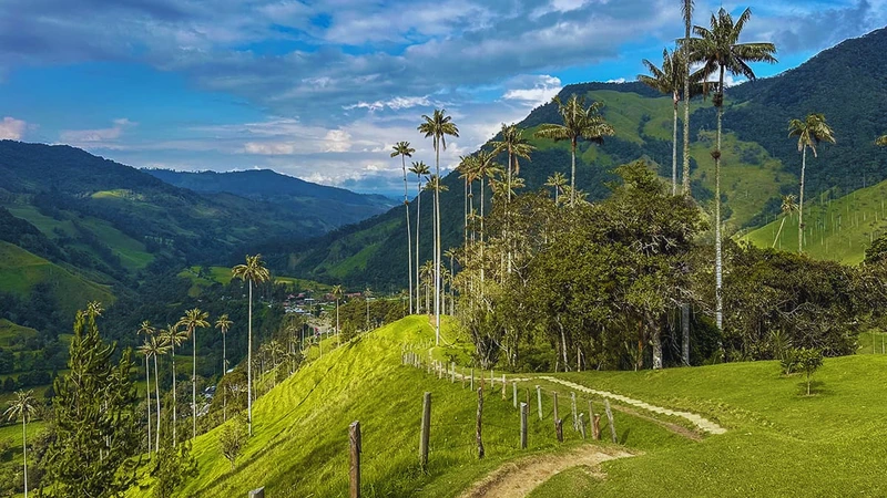
The famous loop runs about 12 to 13 km. Most hikers need five to seven hours, including breaks. The path includes forest, river crossings, steep climbs and open pasture. It is not technical, but it can be muddy and tiring.
Sources disagree on direction. Some hikers go clockwise for early palm photos. Others prefer counterclockwise to take the steep section on the way up. Ask your driver or a local guide, and pick the direction that suits the weather.
Stage 1: The river and cloud forest
The trail starts near the Cocora trailhead and follows a stream into the forest. You cross several narrow suspension bridges. Take them one person at a time. The path is shaded, damp and often muddy, so tall rubber boots or sturdy shoes help.
Listen for birds as you climb. The forest feels quiet and green, with moss on the trunks and mist in the trees. It is a lovely contrast to the open meadow that comes later.
Stage 2: Acaime hummingbird reserve
Many hikers detour to the Acaime reserve, a small farm with hummingbird feeders. You can watch dozens of tiny birds hover and dart while you rest. A hot drink is usually available.
Reports differ on the extra time. One source says about 20 minutes uphill, while another says the detour adds about two hours in total. Plan for the longer figure if you want a relaxed pace. The reserve charges a small entry fee, paid in cash.
Stage 3: Finca La Montaña and the palm meadows
From the junction, a steep climb leads to Finca La Montaña. Expect 30 to 45 minutes of hard walking. The reward is a high viewpoint over the valley. Here the landscape opens, and the wax palms appear above you.
Take your time on the descent. The trail passes through pasture dotted with tall palms, and photo stops come easily. Early light or soft cloud gives the best pictures. Midday sun can flatten the scene.
Stage 4: The walk back
The final section follows the lower valley back to the trailhead. It is gentle but long, and tired legs notice it. Check the time. You want to reach the jeep area before the late-afternoon departures end.
Shorter and Longer Options
You do not have to complete the full loop. If you are short on time, several private farms near the trailhead offer palm viewpoints and short walks. Fees are small and paid at the gate. Recent reports mention places such as Finca El Portón and Finca La Esperanza, but prices change often.
For a bigger challenge, continue beyond Acaime towards Estrella de Agua. Wikivoyage describes about two hours of muddy uphill walking to a farm beside a small alpine lake. This route heads towards the high páramo of Los Nevados. Ask locally about conditions and fees before you commit.
If you love long mountain walks, compare this with trekking from El Chaltén in Patagonia. It is a very different landscape, but the same joy of walking.
Cocora Valley Costs and Cash
Costs are modest, but they add up. You pay for the jeep both ways, entry to private farms, and any extras such as hot drinks. Sources give different figures, and most are undated, so treat every price as a rough guide.
Bring cash. There are no ATMs at the trailhead, and kiosks usually take pesos only. One recent guide suggests carrying around COP 100,000 per person for a full loop with food. Small notes help, because change can be scarce.
Opening times also vary by source. One site lists daily hours from 7:00 am to 6:00 pm, but this is not confirmed by an official page. Start early and finish before dusk.
Best Time to Visit Cocora Valley
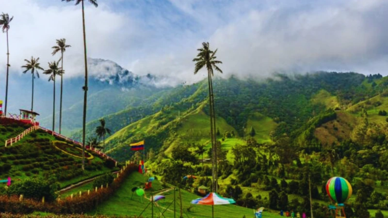
You can visit all year, because the valley stays cool and green. Still, rain is common. Wikipedia reports about 2,000 mm of rain a year, with October and November the wettest months. Trails turn slippery in those weeks.
Drier spells usually fall between December and February and between July and September, according to local travel sites. Even then, expect clouds by afternoon. Start at first light for the clearest skies and the quietest paths.
Weekends and holidays bring more visitors. If you can, go on a weekday. You will share the trail with fewer people and find the jeeps easier to book.
What to Pack and Safety Tips
Good preparation makes the day more fun. The terrain is easy to follow, yet weather and mud can slow you down. Pack light but smart.
- Waterproof jacket or poncho, since showers arrive quickly.
- Tall rubber boots or grippy hiking shoes.
- Two to three litres of water and snacks.
- Sun protection, because UV is strong at altitude.
- Cash in small notes, plus a charged phone.
Altitude is mild but real. If you arrive from sea level, give yourself a day in Salento first. Walk slowly on the first climb, and turn back if you feel unwell. Mobile coverage can be weak in the forest, so tell someone your plan.
Never step into fast water to avoid a bridge queue. Also respect fences and private land. Farmers share their pastures with visitors, and good manners keep the trail open.
Nearby Attractions Around Salento
Salento itself deserves an afternoon. Walk its main street, climb the viewpoint stairs and try local trout or fresh coffee. The town is the oldest settlement in Quindío, and its painted houses make wandering a pleasure.
The wider coffee region is also part of Colombia’s Coffee Cultural Landscape, a UNESCO World Heritage Site. Many farms near Salento run tours that explain how beans become your morning cup. Some travel sites also mention the Santa Rita waterfall near Boquía, though you should check access and fees locally.
If you enjoy alpine valleys, our guide to New Zealand’s Hooker Valley Track shows how an easy walk can still feel epic. For another Andean adventure, read about Choquequirao in Peru.
Important Things Visitors Should Know
Rules, fees and access can change quickly. Parts of the valley lie within a protected national park, while other sections cross private farmland. Because of that, the right entry point depends on your route. Ask at the trailhead or at your hotel in Salento for current advice.
Official tourism and park pages were not available for checking when this guide was prepared. Confirm opening hours, prices and any closures before you travel. Also keep your plans flexible, since heavy rain can close sections of the trail.
Finally, leave no trace. Carry rubbish out, keep noise low near the hummingbird feeders, and never pick plants. Small habits protect a landscape that took centuries to grow.
Conclusion: Is the Cocora Valley Hike Worth It?
Yes, it is. The Cocora Valley hike mixes cloud forest, hummingbirds, swinging bridges and the tallest palms on Earth. It is demanding enough to feel like an adventure, yet simple enough for most fit walkers. Start early, pack for rain, bring cash and respect the land.
Your reward is a view few places can match: slender palms rising from green hills into drifting cloud. Few travellers forget it.
Explore More on LessExplore
Want more inspiration? LessExplore brings you worldwide travel guides, hidden gems, waterfalls, hiking destinations, scenic escapes and practical travel tips. Try our guide to the Marble Caves in Chile for another South American wonder, or browse more natural wonders in Brazil.
Cocora Valley Hike FAQs
Most hikers need five to seven hours for the full 12 to 13 km loop. Adding the Acaime hummingbird reserve or a longer route can extend the day.
Take a shared Willys jeep from Plaza de Bolívar in Salento. The ride takes about 30 minutes, and jeeps leave when full. Confirm the fare and your return time with the driver.
The drier months are usually December to February and July to September. Rain is possible all year, and October and November are often the wettest. Start early for clearer skies.
It is moderate. The trail is well marked, but it includes mud, steep climbs and high altitude. Good footwear and a steady pace make it manageable for most fit walkers.
Quindío wax palms can reach up to about 60 metres. They are Colombia’s national tree and often called the tallest palms in the world.
Fees, schedules and trail conditions change. Always confirm current details locally before you travel.