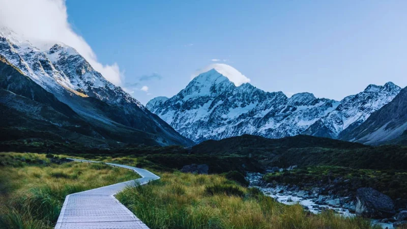
Few walks in the world deliver such a big mountain view for so little effort. The Hooker Valley Track in New Zealand’s South Island follows a glacial valley to a lake full of floating ice, with Aoraki/Mount Cook filling the sky ahead. This guide explains the route, the swing bridges, parking, weather and the best time to go.
It also covers the practical details that catch visitors out, including a few safety rules. Read on, and you will know exactly how to plan your day in the park.
Hooker Valley Track Overview
The Hooker Valley Track sits in Aoraki/Mount Cook National Park, in the central South Island. According to DOC’s Aoraki/Mount Cook National Park page, the park holds 19 peaks over 3,000 metres, and glaciers cover about 40 percent of it. That is a lot of ice for one small park.
The walk itself is simple. Tourism New Zealand lists it at about 10 km return, and the Department of Conservation’s Hooker Valley Track page gives a return time of about three hours. The same DOC page rates the track as easy, with a gravel surface and some steps. Most people finish it in three to four hours, including photo stops.
Because the gradient is gentle, the track suits families, casual walkers and first-time hikers. Even so, the mountain weather is serious. We cover that in the safety section below.
A Little Background on Aoraki
At 3,724 metres, Aoraki is New Zealand’s tallest peak, as the DOC park page states. For Ngāi Tahu, it is the most sacred of ancestors. DOC explains the traditional story: Aoraki was a young boy whose canoe was stranded on a reef. He and his brothers were turned to stone, and they became the Southern Alps.
The European name came later. Captain J. L. Stokes named the mountain Mount Cook in 1851, in honour of Captain James Cook. Today the park uses both names together. DOC also notes that the Hooker Valley area has Tōpuni status, which recognises its cultural importance to Ngāi Tahu. Keep this in mind as you walk, and treat the landscape with respect.
Where the Hooker Valley Track Starts
The track begins at White Horse Hill car park, at the end of Hooker Valley Road off State Highway 80. From Aoraki/Mount Cook Village, DOC says to follow SH80 towards Twizel. Hooker Valley Road is the first turn on the left as you leave the village, so the drive is only a few minutes.
Facilities at the start are good. The White Horse Hill Campground has wheelchair-accessible toilets, a public shelter with tables and seating, and treated drinking water. Another set of toilets is available about 15 minutes after the second swing bridge. Plan your water and snacks accordingly.
Parking at White Horse Hill
Parking is paid. DOC lists the charge as $2.50 per half hour or $25 a day, and it is free if you arrive and leave within 20 minutes. Payment is by debit or credit card at the machines, and cash is not accepted. Spaces can also be limited from November to March, between 10 am and 4 pm. As a result, an early start is the smartest option in summer.
The Walk: From Car Park to Hooker Lake
DOC splits the track into three sections of 1 km, 1.5 km and 2.5 km. These add up to about 5 km each way. The views keep changing, so the time passes quickly.
First Section: Mueller Valley Views
The first stretch leads to the first swing bridge over the Hooker River. Along the way, short side tracks lead to Freda’s Rock, the Alpine Memorial and the Mueller Lookout. The memorial is worth a quiet pause. From the Kakīroa/Mount Sefton View Lookout, you can see Mueller Lake, Mueller Glacier and Kakīroa/Mount Sefton.
Middle Section: The Swing Bridges
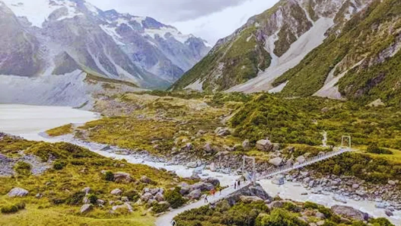
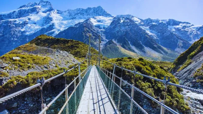
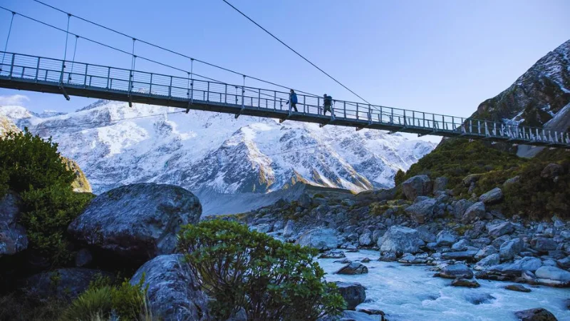
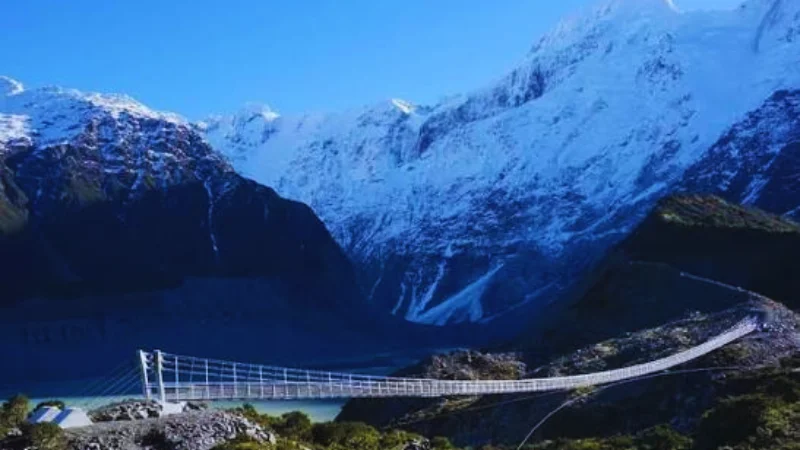
The Hooker Valley Track is famous for its three swing bridges. They are the highlight for many walkers, and they make great photo spots. DOC also reports that a new second swing bridge opened over the Hooker River in July 2026. It is 189 metres long, and DOC describes it as the longest suspension bridge in New Zealand.
The bridges are a good reminder of the wind here. The Hermitage, a hotel in the village, notes that the second bridge can close in strong wind. Therefore, check conditions before you set out, and be ready to turn back if needed.
Final Section: Hooker Lake
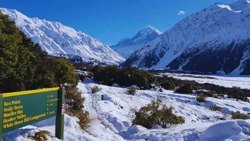
After the third and final swing bridge, the path reaches Hooker Lake. DOC says the track ends here, with views of Aoraki/Mount Cook and the Southern Alps. In summer, icebergs speckle the lake. Most walkers sit on the shore for a while, eat a snack and simply look.
However, the lake needs care. DOC states that the water is typically about 3 degrees Celsius. Do not enter the lake, walk on frozen ice or climb on icebergs. The lakeshore is the viewpoint, and that is the safest and best place to enjoy it.
Best Time to Visit the Hooker Valley Track
The track is open all year, according to Tourism New Zealand, so there is no wrong season. Each one simply feels different.
Summer: Long Days and Icebergs
Summer brings the longest days and the best chance to see icebergs on the lake. It is also the busiest time. DOC warns of high visitor numbers on this track, and car park spaces can be limited. Start early, ideally before the day-trip crowds arrive.
Autumn and Spring: Quieter Walks
Shoulder seasons often give quieter paths and crisp air. The weather can still turn quickly, though. Pack layers whatever the forecast says.
Winter: Snow, Ice and Fewer People
Winter can be stunning, but it needs more preparation. DOC says the track can become very icy in shaded areas, and it recommends microspikes and hiking poles. It also warns that snow can close State Highway 80, and that access to the park may be limited from June to September. Check road conditions before you travel.
How to Get to Aoraki/Mount Cook
The park is reached from State Highway 8, at the end of State Highway 80. DOC lists Queenstown as a 3.5-hour drive and Christchurch as a 4.5-hour drive. Twizel and Tekapo are the closest towns with supermarkets and services, at roughly one hour and 1.5 hours away.
DOC’s park page does not list any public transport into the park, so most visitors drive. If you are planning a longer South Island trip, build in extra time for photo stops on the way.
Where to Stay and Eat
The village has a DOC visitor centre, a petrol station and a day shelter with coin-operated showers. Food and drink options are limited, so bring supplies from Twizel or Tekapo. The Hermitage runs the Sir Edmund Hillary Café, which its own track guide recommends before or after the walk. Campers can use the White Horse Hill Campground, which is right at the trailhead.
A Simple Plan for Your Hooker Valley Day
A relaxed day works best. Arrive at White Horse Hill car park early, use the toilets and fill your water bottle at the shelter. Walk steadily to the first bridge, then slow down and enjoy the side lookouts.
Reach Hooker Lake by late morning, and give yourself at least 30 minutes there. Then walk back the same way, because the views look different in the opposite direction. Finish with a hot drink at the Hermitage, and you will have a full, easy day in the mountains.
Safety, Rules and What to Pack
The valley is easy underfoot, but it is still an alpine environment. DOC reports very fast changes in weather, with strong wind, heavy rain, snow and sharp temperature drops possible at any time of year. Treat the forecast as a starting point, not a promise.
- Clothing: carry warm and waterproof layers, sunscreen and plenty of water, as DOC advises.
- Footwear: sturdy shoes work well on the gravel, and microspikes help in icy winter conditions.
- Dogs: dogs are not allowed in the park.
- Fires: there is a permanent fire ban.
- Drones: flying without a permit is strictly prohibited.
- Rubbish: bins are limited, so take all waste out with you.
One more important point concerns track status. Sources disagree about whether parts of the track have been closed during recent bridge works. Tourism New Zealand shows a partial closure notice, while DOC’s page does not mention one. Because conditions change, check the DOC alerts or call the visitor centre before you go.
More Things to Do Near the Hooker Valley Track
If you have more time, the park rewards a second day. The Mueller Hut track starts near the White Horse Hill car park, so check DOC for its conditions first. DOC also says the Tasman Glacier, New Zealand’s longest glacier at 23 km, is clearly visible from the main highway at the park entrance.
After dark, the park is one of the best places in New Zealand to view the night sky, says DOC. The Hermitage has telescopes and a planetarium. During the day, listen for kea, the cheeky mountain parrots, and look for the Mount Cook buttercup beside the track.
Plan Your Own Mountain Valley Walks
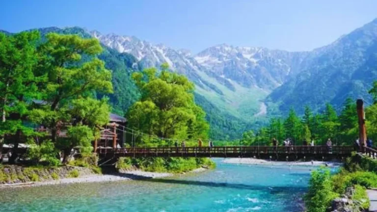
The Hooker Valley Track belongs to a small group of walks that combine big scenery with gentle terrain. If you like this style of trip, you may enjoy our guide to Kamikochi in Japan, where a car-free valley path follows a clear river beneath the Japan Alps. For a more demanding option, read about the trekking trails around El Chaltén in Argentina.
Lake lovers can compare Hooker Lake with Oeschinensee in Switzerland, which offers a very different alpine mood. Meanwhile, the Lauterbrunnen Valley shows how many waterfalls one Swiss valley can hold.
Hooker Valley Track FAQs
The Hooker Valley Track is about 10 km return. DOC lists a return time of about three hours, and Tourism New Zealand says to allow three to four hours in total.
No. DOC rates it as easy, with a gravel surface and some steps. The main challenges are wind, cold and changing weather, not steep climbs.
Park at White Horse Hill car park, at the end of Hooker Valley Road. DOC lists a charge of $2.50 per half hour or $25 a day, paid by card only. Spaces can fill up between 10 am and 4 pm from November to March.
No. DOC states that dogs are not allowed in Aoraki/Mount Cook National Park. Plan pet care before you visit.
Summer offers long days and icebergs on Hooker Lake, but it is busy. Autumn and spring can be quieter. In winter, expect ice and bring microspikes. The track is open all year, so check DOC alerts before you go.
Final Thoughts on the Hooker Valley Track
The Hooker Valley Track proves that a great mountain day does not need a hard climb. In about three hours, you cross swing bridges, follow a glacial river and reach a lake beneath Aoraki/Mount Cook. Start early, pack for all weather, and check the DOC alerts before you leave.
Ready for more? Explore LessExplore for worldwide travel guides, hidden gems, waterfalls, hiking destinations, scenic escapes and practical travel tips. A good next read is our Rigi Kulm guide for another memorable mountain day.
Fees, rules and track conditions change. Always confirm details with the Department of Conservation before you travel.