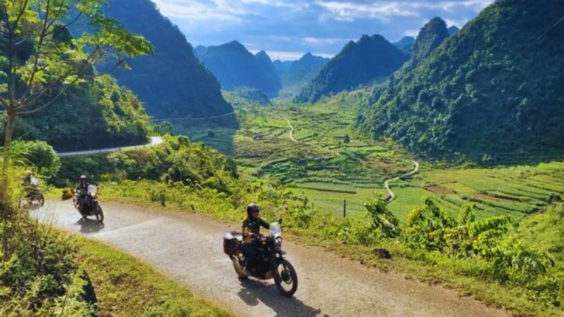
Imagine a road that climbs through limestone peaks, hugs the edge of a deep canyon and ends at Vietnam’s far northern border. That road is the Ha Giang Loop. It winds through the Dong Van Karst Plateau, a rugged highland of terraced fields, stone villages and market towns. For many travellers, it is the wildest and most rewarding journey in northern Vietnam.
This guide explains the route, the best time to go and how to get there from Hanoi. You will also find notes on permits, driving rules and safety. Where sources disagree or details may change, we say so, so you can check before you travel.
What Is the Ha Giang Loop?
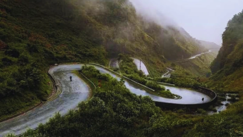
The Ha Giang Loop is a circular road trip through Ha Giang, described by UNESCO as Viet Nam’s northernmost mountainous province. Most people start and finish in Ha Giang city. Along the way they pass mountain passes, small towns and farming valleys close to the Chinese border.
Vietnam Tourism describes the route as running along the QL4C highway northeast from Ha Giang to Bao Lam, then returning on the QL34 road. We could not find a single reliable figure for the total distance, so we will not quote one. Plan by days instead. Local guides often suggest three to five days, and four is a comfortable pace for most visitors.
The Dong Van Karst Plateau Geopark
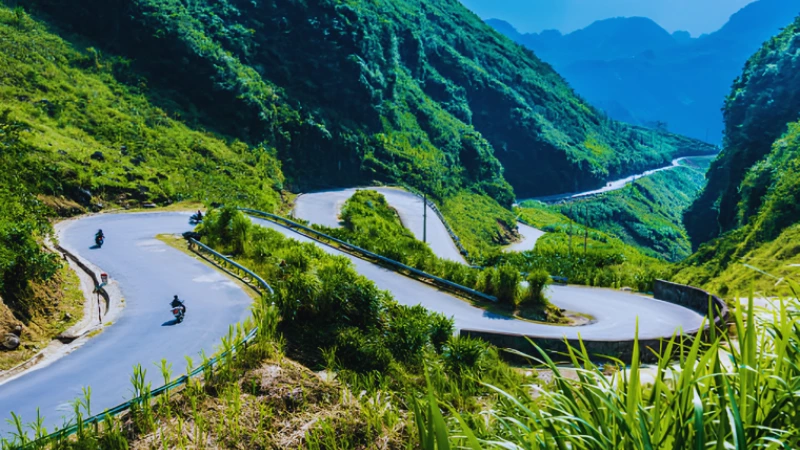
Much of the loop lies inside the Dong Van Karst Plateau. According to UNESCO’s Dong Van Karst Plateau Global Geopark page, it became a UNESCO Global Geopark in 2015. The geopark covers about 234,500 hectares, and limestone makes up roughly 60 percent of the area.
The same page says the rocks record more than 550 million years of geological history. The Tu San canyon drops 700 to 800 metres. The highest peak, Mieu Vac Mount, reaches 1,971 metres. This is dramatic country, and the scenery changes around almost every bend.
People shape the landscape as much as rock does. UNESCO lists 17 ethnic groups in the geopark, and more than 60 percent of residents are Mong. Fields cling to steep slopes, and markets bring villages together. Visit with respect, ask before taking portraits and buy local goods where you can.
Best Time to Visit the Ha Giang Loop
Autumn is the most popular season. North Vietnam travel sources describe September to November as the best window, with golden rice terraces early on and flowers later. Spring, from March to May, is also pleasant. Summer brings heat and heavy rain. One travel site notes that landslides and slippery roads are more likely in the wet months.
Buckwheat Flower Season
The pink and white buckwheat flowers are a highlight. Vietnam Tourism’s buckwheat guide says the flowers appear from October through December. White blooms start in late September, turn pink from October into November and become deep red by late December. The same page says a local festival is typically held in Dong Van district in mid-to-late November.
Timing varies from year to year, so treat these months as a guide. The page names Lung Cam village in the Sung La Valley as a place with abundant blooms. It also mentions Thach Son Than and the Ma Pi Leng Pass.
Winter and Summer
Winter is cooler and can bring fog, which spoils views and makes riding harder. Sources disagree on exact winter temperatures, so pack layers and check a recent forecast. In summer, bring rain gear and allow extra time, because wet roads slow everyone down.

How to Get to Ha Giang From Hanoi
Ha Giang city lies roughly 300 kilometres from Hanoi, according to North Vietnam travel guides. There is no airport or train station in the city. Buses are the usual choice, and Vietnam Tourism says the journey takes about six hours.
- Bus or limousine van: The simplest option. Services run regularly from Hanoi, and Vietnam Tourism mentions the My Dinh bus station. Prices vary, so check current fares.
- Private car: Often takes five to six hours, according to one guide. It suits groups or anyone short on time.
- Motorbike from Hanoi: Possible, but long and tiring. Most travellers prefer to take the bus and start riding in Ha Giang.
A Four-Day Ha Giang Loop Itinerary
The route below follows the stops in Vietnam Tourism’s four-day Ha Giang Loop itinerary. It is a good starting plan. Adjust it to your pace and the weather.
Day 1: Ha Giang City to Yen Minh
Leave Ha Giang city and climb to Heaven’s Gate (Quan Ba), the first big viewpoint on the loop. Stop for lunch in Tam Son. Then continue to Yen Minh for the night. It is a short, scenic first day that lets you settle into the road.
Day 2: Nine Turn Pass to Dong Van
Cross the Chin Khoanh (Nine Turn) Pass, then pause around Sa Phin for food and fuel. The Hmong King’s Palace is also in this area. Vietnam Tourism describes the Lung Cu Flag Tower as a three-hour detour. It marks the northernmost point of Vietnam, and one guide gives its height as 1,470 metres. Overnight in Dong Van, where the old town is worth a stroll.
Day 3: Ma Pi Leng Pass to Bao Lam
This is the star of the trip. The Ma Pi Leng Pass runs for roughly 20 kilometres along cliffs above the Nho Que River, according to one local guide. It was built in the 1960s. Sources disagree on its height, so we leave it out. Meo Vac is only 24 kilometres from Dong Van, and a side road leads down to the Nho Que River before you reach Bao Lam.
Day 4: Bao Lam to Ha Giang City
The last day is calmer. You ride through Bac Me, where roadside food stalls offer a simple lunch, and return to Ha Giang city. If you can stretch the trip to five days, add an extra night in Dong Van or Du Gia.
Markets are a fun part of the trip. Guides mention weekly markets in Dong Van and Meo Vac, with Sunday as the busy day. Check the day when you plan your route.
Permits, Licences and Rules
Rules for foreigners change, so confirm them before you ride. One guide says visitors need a border-area permit for places such as Dong Van, Lung Cu, Yen Minh and Meo Vac. It lists a fee of about 230,000 to 300,000 Vietnamese dong, issued at the Ha Giang police station. Hotels and rental shops may arrange it. Vietnam Tourism does not mention a permit on its itinerary page, so ask your accommodation for current advice.
Licences matter as well. The same guide says police often check riders and that an International Driving Permit plus the correct motorcycle licence are expected. Fines or confiscation are possible. We could not confirm the rules with an official source, so check your own country’s licence and your insurance cover before you go.
Note that one source says Ha Giang Province merged into Tuyen Quang Province in 2025. Older guides may use the earlier name, and local procedures could differ. Treat any old fee or office detail with caution.
Should You Ride Yourself or Hire a Driver?
Roads on the loop are paved and mostly in good condition, but they are steep and winding. Vietnam Tourism warns that construction and obstacles can appear at any time. Beginners may find the bends tiring and the traffic unpredictable.
If you have little riding experience, consider a driver or an easy-rider guide, or travel by car. You still see the same landscapes, and you can enjoy the views. Experienced riders can rent a motorbike in Ha Giang city, where Vietnam Tourism notes that service centres are available. Check brakes, tyres and lights before every ride.
Safety and Practical Tips
- Ride in daylight: Vietnam Tourism advises stopping after dark. Fog and tight curves make night riding risky.
- Avoid heavy rain: Wet roads and landslides are a real hazard, especially near Ma Pi Leng.
- Carry cash: ATMs are scarce outside Ha Giang city. Guides mention machines in Dong Van and Meo Vac, but small villages usually have none.
- Plan fuel stops: Fill up whenever you pass a station in remote stretches.
- Book ahead in peak season: Popular stops can sell out quickly, as Vietnam Tourism notes.
- Wear proper gear: Use a good helmet, sturdy shoes and a rain jacket.
- Pack layers: Mountain weather changes fast, even in the warm months.
Where to Stay Along the Loop
Most travellers sleep in family homestays. Yen Minh, Dong Van, Meo Vac and Bao Lam are common overnight stops. Du Gia is another homestay area for those who prefer quieter villages. Evening meals are often shared, and cash is usually preferred. Ask in advance about heating in cooler months.

Photography Tips
Early light is best at the big viewpoints. Heaven’s Gate and Ma Pi Leng can fill with cloud by midday. A wide lens suits the canyon, while a telephoto lens picks out terraced fields and village roofs. In flower season, golden evening light over the buckwheat fields is hard to beat. Always ask before photographing people.
Other Mountain Escapes in Asia
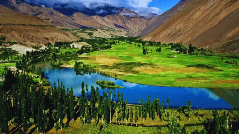
If the Ha Giang Loop whets your appetite for high places, Asia has many more. Try the lush green hills in our guide to Ella in Sri Lanka. For crisp alpine scenery, read about Kamikochi in Japan. Those who love remote valleys will enjoy Phander Valley in Pakistan.
Southeast Asia offers gentler options too. See our slow-travel guide to Kampot in Cambodia, or step into history with the ancient city of Mrauk-U.
Why the Ha Giang Loop Is Worth the Ride
The Ha Giang Loop combines big scenery with real local life. Limestone peaks, deep canyons, market towns and seasonal flowers fill every day. With sensible timing, a solid plan and respect for the road, it is a journey you will remember for years.
Pick autumn if you want flowers, give yourself four days, and keep your plans flexible. Check permits and licence rules before you set off, and the rest will take care of itself.
Frequently Asked Questions About the Ha Giang Loop
Most guides suggest three to five days. Four days is a comfortable pace and matches the itinerary on Vietnam Tourism’s website.
September to November is the most popular window. Buckwheat flowers bloom from October through December, according to Vietnam Tourism. Summer is wet, and winter can be foggy and cold.
One travel guide says foreigners need a border-area permit for some towns, costing about 230,000 to 300,000 dong. Vietnam Tourism does not mention one, so ask your accommodation for current rules.
Take a bus or limousine van. Vietnam Tourism says the trip takes about six hours. Ha Giang has no airport or train station, and private cars take roughly five to six hours.
The roads are paved but steep and winding. Beginners should consider a driver or an easy-rider guide, avoid night riding and skip rainy days, especially near Ma Pi Leng.
Final Thoughts on the Ha Giang Loop
Ready for more? Explore LessExplore for worldwide travel guides, hidden gems, waterfalls, hiking destinations, scenic escapes, adventure experiences and practical travel tips. You might start with our guide to Lauterbrunnen Valley or browse the top waterfalls in Victoria, Australia.
Permits, fees, road conditions and timings change. Check official and local sources before you travel.